
Minneapolis ZIP Code Service Areas
Postal geography does not follow Minneapolis neighborhood, ward, parcel, or city-boundary lines. The official Minnesota metro ZIP map gives a broad orientation, while the United States Postal Service assigns delivery ZIP codes. The code set found in official Minnesota map and reporting material includes downtown, south, north, northeast, university, government-mail, specialized, shared, and nearby suburban service areas. Use the table as a starting index, not as proof that every address in a range is inside the city.
| ZIP code | Areas covered | Post office | Notes |
|---|---|---|---|
| 55401-55405 | Downtown and central Minneapolis | Verify through USPS address or city lookup | Confirm the full address before using municipal or parcel records. |
| 55406-55410, 55417-55419 | South Minneapolis service areas | Verify through USPS address lookup | A ZIP narrows delivery geography, not a resident list. |
| 55411-55414, 55418 | North and northeast service areas | Verify through USPS address lookup | Use the street address for a parcel or city record. |
| 55416, 55424, 55426-55427, 55431, 55435-55439, 55441-55449 | West and southwest shared or suburban-edge areas | Verify through USPS | Many codes extend beyond Minneapolis city limits. |
| 55454-55455, 55487-55488 | University/Cedar-Riverside and county or government mailing functions | Verify through USPS reverse lookup | Do not infer a city jurisdiction from a postal designation. |
| 55470, 55472-55474, 55478-55480 | Specialized or box and unique mail uses | Verify through USPS | Current contents were not located in the official research. |
The official Minnesota Metro ZIP Code map is the best broad reference located for this geography. It shows why a ZIP code directory needs an address-level check before a postal area is treated as a civic boundary.
Minneapolis Postal Service Footprint
The Minneapolis-related inventory is wider than the city itself. In addition to the ranges above, official materials identify 55415, 55420, 55421, 55423, 55425, 55428-55430, 55436-55438, 55450, 55458, and 55467 among the postal codes encountered in the Minneapolis service footprint. That broad list is intentionally not a claim that each code is wholly within Minneapolis. Postal cities, route areas, and municipal jurisdictions can overlap without matching.
For everyday orientation, downtown and central addresses cluster in the low 55401 through 55405 range. South Minneapolis commonly uses 55406 through 55410 and 55417 through 55419. North and northeast locations commonly use 55411 through 55414 and 55418. Those patterns help select a starting point, but the USPS result for one full address is more reliable than a neighborhood assumption.
USPS Tools for Minneapolis ZIPs
The USPS postal lookup provides three documented routes: find a ZIP from an address, find ZIPs from a city and state, or reverse-check a ZIP. Its exact button wording can change, but the input logic is stable enough to make it the first postal verification step. The result confirms delivery geography. It does not identify every person connected to that code.
| Lookup route | Information used | Best use |
|---|---|---|
| Address lookup | Street, city, and state | Confirm the ZIP for one complete Minneapolis address. |
| City lookup | City and state | See ZIP options associated with a postal city. |
| Reverse ZIP lookup | ZIP code | Check the postal city or service reference for a code. |
The USPS address, city, and ZIP lookup screen is shown below. It is the right place to resolve a code before comparing an address with county or city records.
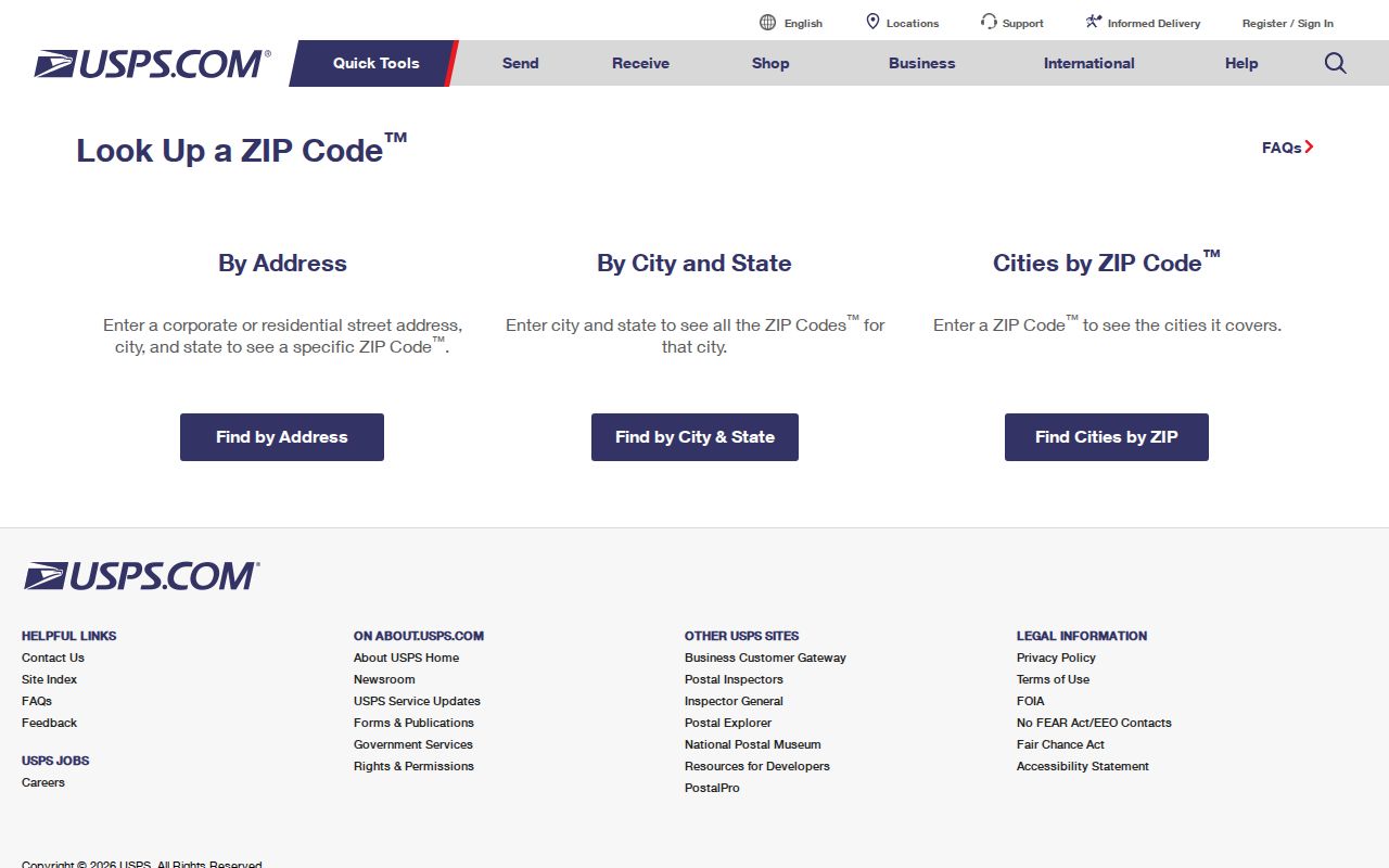
After the postal result is known, use the complete street address for the next record system. A ZIP-only result cannot establish a parcel, structure, or current occupant.
Search Within a Minneapolis ZIP Code
A ZIP code can narrow a known-address search, but the research did not locate an official unrestricted ZIP-wide resident roll. Hennepin property search is keyed to house number and street, PID, or addition name. Minnesota voter registration confirmation asks for a named person and address details. These tools answer specific, bounded questions, so begin with a real address rather than trying to turn a ZIP into a list of households.
- Verify the complete address and ZIP with the USPS tool, including a unit when it is part of the delivery address.
- Use the address in Hennepin Property Information Search to reach the individual parcel record.
- Save the 13-digit PID, legal description, assessment date, and map reference when the parcel is the right one.
- Use the City Address Portal for ward, precinct, fire, snow, garbage, and other city-service context tied to that address.
- For registration status, use the state tool only with its required name, birth date, ZIP or county, house number, street, and unit information.
Once the ZIP has narrowed the area to a known street, the address-by-address method belongs in the Minneapolis street directory. A parcel result may show ownership information, but it is not proof that a named owner currently lives there.
Minneapolis Postal Field Checks
Hennepin PINS accepts a required house number and street name, with an optional unit. It also supports a 13-digit PID or a lot, block, and abbreviated addition-name search. The database updates on weekday evenings at about 9:15 p.m. Central Time. It is for individual parcel searches, and the county prohibits bulk downloading or scraping. Enter a street with at least three characters and try the county’s recognized abbreviations or a direction at the end when a first search fails.
The Minneapolis Address Portal uses an address or property ID, called an APN there, plus an optional unit. It can connect a result to city-service and district context. The two systems complement each other: PINS ties the address to county parcel data, while the city portal routes the address into municipal information.
The state voter-registration lookup also uses ZIP geography in a narrow way. It requires first and last name, date of birth, and either ZIP or county mode. ZIP mode then asks for the ZIP, house number, street selection, and a unit when the address includes one. A match can confirm registration status and provide related election information. It does not create a ZIP-wide directory, and an official change can take up to 14 days to appear even though the data update nightly.
Hennepin voter-data requests follow a different route through the county data-request portal. The requester must be a registered Minnesota voter, provide photo identification, and comply with the use limits in Minn. Stat. §201.091. That distinction matters: an address check and a restricted voter-data request are not interchangeable forms of postal-area research.
Note: A shared-lobby building can have one searchable master address, so search the building number first and add a unit only after that result works.
Minneapolis ZIP Codes and City Lines
The most important postal boundary limit is simple: USPS delivery areas are not Minneapolis legal boundaries. A ZIP can extend into another municipality, and a postal city label can differ from the municipal jurisdiction that maintains the parcel or service record. The city’s quadrant map, a ward, a neighborhood, a police precinct, and a tax parcel are also separate geographic systems.
The Census uses ZIP Code Tabulation Areas, or ZCTAs, for statistics. ZCTAs approximate delivery geography and are not official USPS ZIP boundaries. They should not be used to decide a household’s city jurisdiction, voting district, parcel, or school boundary. Match the address to the appropriate county or city source instead.
Minneapolis Postal Definitions
Postal terms often look more precise than they are. The following labels help separate a delivery code from the parcel and city records used for Minneapolis research.
- ZIP code
- A USPS delivery-area code. It organizes mail, not municipal boundaries or property ownership.
- ZIP+4
- An added four digits that refine delivery routing for part of a block, building, or other delivery segment.
- PO-box ZIP
- A code used for post-office boxes. It may not describe the box holder’s physical location.
- Unique ZIP
- A code associated with a specialized mail use or institution. Confirm its current role with USPS.
- Carrier route
- A mail-delivery sequence inside a ZIP. It is not a neighborhood or governmental district.
Minneapolis Postal Maps Are Not Records
A map is useful for orientation, not for deciding who is tied to an address. The official metro map can show a postal-area pattern, while the parcel map and property record show tax geography. The city address standard adds another layer because an address is assigned to a parcel or structure and can change when a parcel is split, combined, moved, or otherwise revised.
For a historical question, preserve the original address spelling and compare it with the current number, street abbreviation, direction, PID, and legal description. Minneapolis changed its terminology from building numbering to parcel and structure numbering in 2004. An older address can therefore be real and still fail in a current structure search without more context.
Minneapolis Postal Search Limits
Postal, parcel, and voter systems have different purposes. The Minnesota voter tool confirms registration status for an identified person and requires name, date of birth, ZIP or county, house number, street, and sometimes a unit. It is not an unrestricted list. A public voter-data request has its own identification and permitted-use requirements under Minnesota law, and users cannot publish a searchable copy or use the data outside the statutory limits.
Likewise, Hennepin PINS presents public parcel information for an individual search. Its fields can include tax status, assessment values, parcel description, sales, recent recording history, and a map. Those details identify a record snapshot, not a complete account of who lives at an address. Keep source dates, respect the agency’s terms, and do not use record fragments to harass, monitor, or expose anyone.
Note: When postal and property results disagree, retain both results with dates and ask the relevant custodian which geography governs the question at hand.